 Hakkenden Bōsō and Miura Map
 Introduction
Glynne Walley recently released the first part of his translation of 南総里見八犬伝 Nansō Satomi hakkenden or The Lives of the Eight Dogs of the Satomi of Southern Fusa (or sometimes just The Eight Dog Chronicles) by Kyokutei Bakin. The excellent and entertaining fist volume, however, did not include any maps to see the geography of the conflicts of the first part (perhaps future volumes will include them?). Luckily, the excellent Hakkenden website, 白龍亭 The White Dragon Pavilon, has an abundance of Hakkenden maps. I highly encourage you to check out the site for summaries, maps, character lists, and all kinds of helpful Japanese-language resources related to Hakkenden. Mr. Opaku, the owner of the site was kind enough to give me permission to reproduce his map of the Bōsō and Miura area, where the action of the first part of the story takes place, with translations and transliterations of the place names. My usage follows that of the Walley translation, but any errors are my fault alone. Please let me know if you find any.
You can find the original Japanese map by Mr. Opaku here. It includes explanations for each place name!
Map
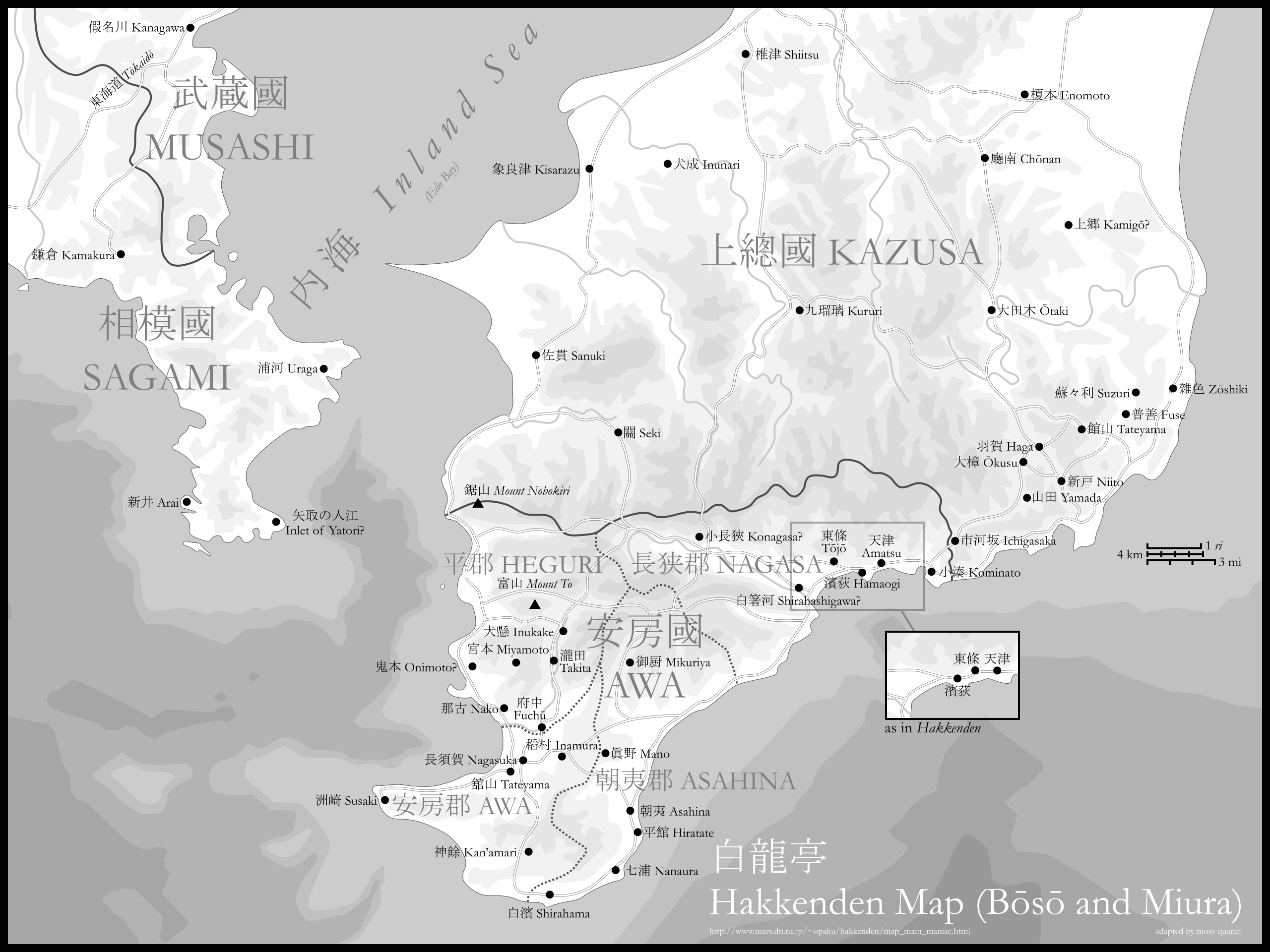
Note that today, 富山 (To-yama) Mount To is known as Tomi-san, and 鋸山 (Nobokiri-yama) Mount Nobokiri is today’s Nokogiri-yama.